IMT & Agency GIS Deployment
Self-sufficient GIS and UAS support deployed directly to Emergency Operations Centers and field command during active disaster response
Current Availability: Available for Deployment
Recent Deployment Experience
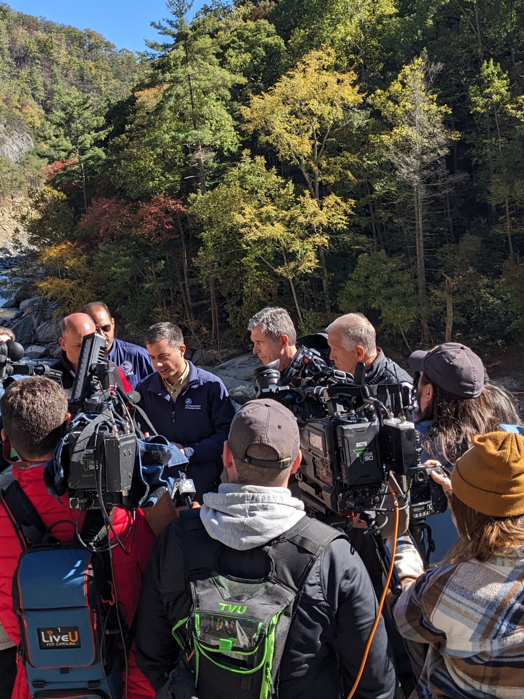
Haywood County IMT – Hurricane Helene (2024)
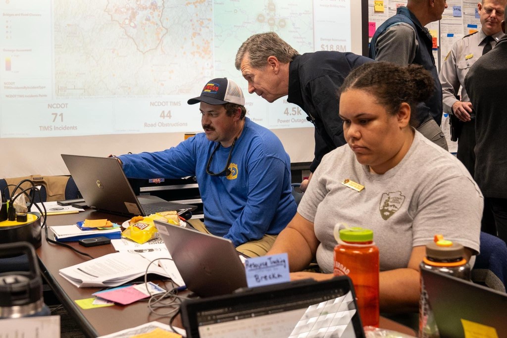
Situation Unit Leader – Emergency Coordination Center (Initial Response)
GIS Specialist – Planning Section, Operations IMT (Duration of Incident)
- Served as Situation Unit Leader during initial emergency response, managing situational awareness and operational picture for command staff
- Transitioned to GIS Specialist role in Planning Section as Operations IMT stood up, providing geospatial analysis and decision support
- Instrumental in implementing first rural Post Emergency Canvasing Operation (PECO) in US history, coordinating needs assessment across 10,000+ residences
- Served as lead UAS Pilot, embedded with FEMA and NCEM USAR teams for aerial reconnaissance supporting victim recovery operations
- Developed substantial damage assessment tools and situational awareness dashboards for real-time decision support
Haywood County Deployment – October 2024
Haywood County IMT – Winter Storm Fern (2026)
GIS Specialist – Planning Section, Haywood County Emergency Coordination Center
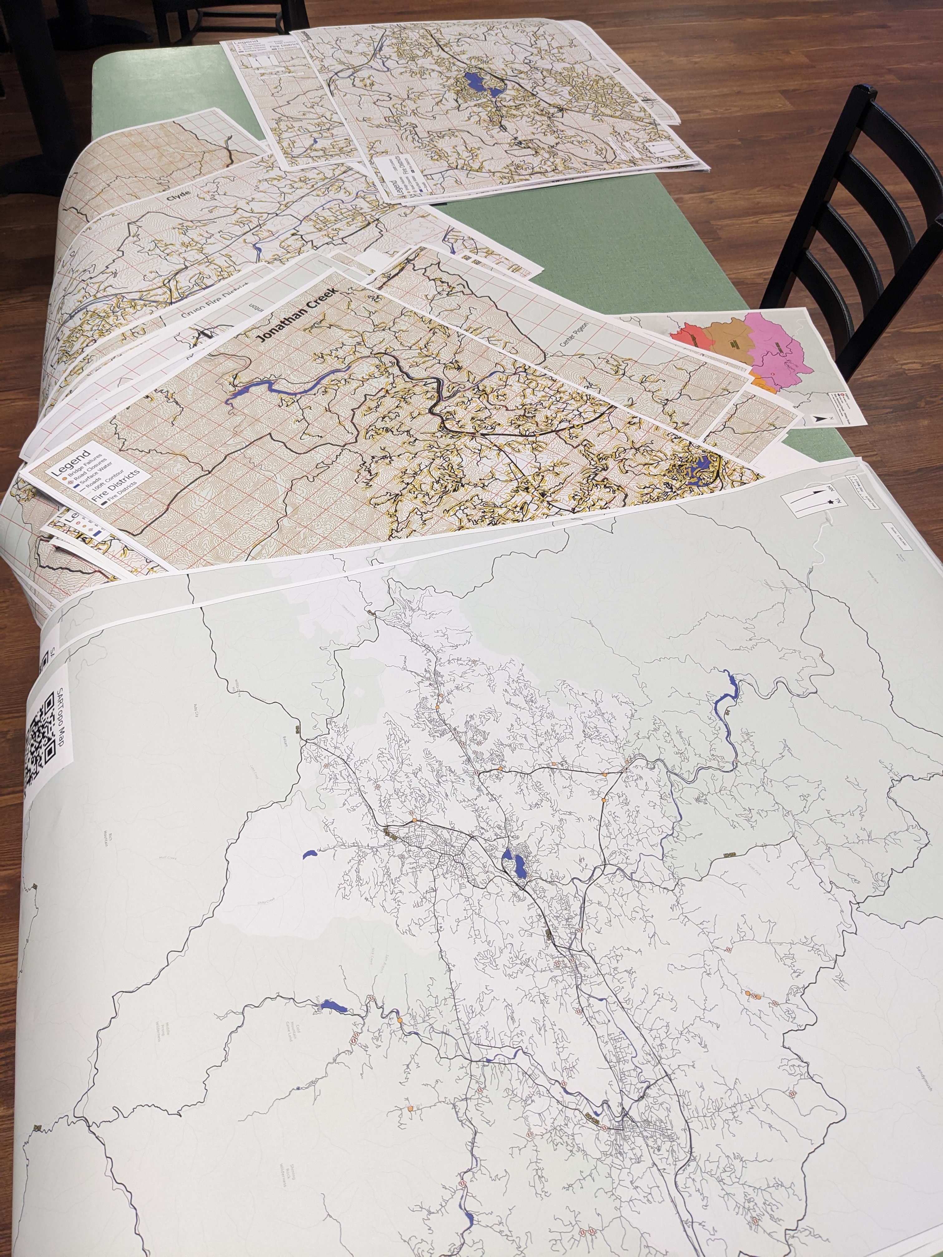
- Updated fire district maps for emergency response coordination
- Enhanced situational awareness dashboards for real-time operational picture
- Managed weather intelligence and forecast tracking for county leadership decision support
What I Deploy
Self-Sufficient Infrastructure
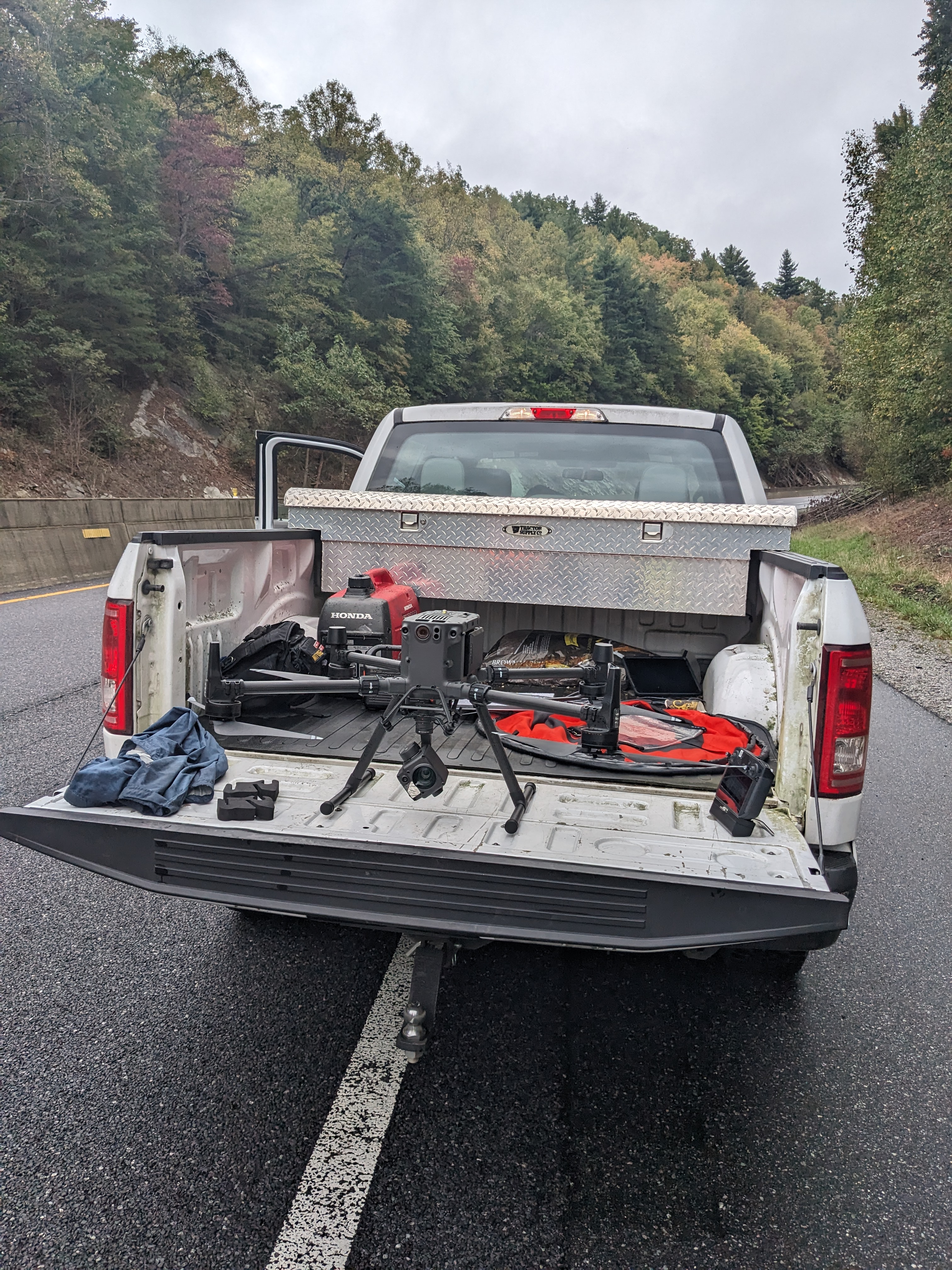
- Independent Power: Generator and battery systems—fully operational without external power
- Starlink Connectivity: Satellite internet functional in infrastructure-degraded environments
- Mobile GIS Workstation: Complete ArcGIS Pro, ArcGIS Online, and QGIS capability
- Large-Format Printing: Mobile plotter for on-demand map generation in field or command post
Core Capabilities
- Situational Awareness Mapping: Real-time operational picture development and updates
- Damage Assessment: Substantial damage analysis and FEMA documentation support
- UAS Operations: FAA Part 107 certified for aerial mapping, reconnaissance, and documentation
- Dashboard Development: Real-time data visualization for command staff
- Field Operations: Embedded support with USAR teams and ground operations


Deployment Details
Coverage & Timeline
Coverage Area: United States
Rapid Deployment: Southeast US (NC, SC, GA, TN, VA, FL) – 24-48 hours from initial contact
Best Engaged: Within 72 hours of disaster declaration or during pre-positioning for anticipated events
Qualifications
- Type 3 All Hazard Incident Management Team Course (O-305)
- ICS-300: Intermediate Incident Command System for Expanding Incidents
- ICS-400: Advanced Incident Command System for Command and General Staff
- G-191: ICS/EOC Interface
- FAA Part 107 Remote Pilot Certificate
- CERT – Community Emergency Response Team Basic Training
Operational Focus
- Emergency Operations Center (EOC) and field command GIS support
- Situational awareness mapping and real-time decision support
- Damage assessment and FEMA documentation
- Aerial mapping and reconnaissance operations
- Real-time operational dashboards and executive reporting
- Embedded field operations with ground teams
Request Deployment
For counties and Incident Management Teams needing GIS and UAS support during active disaster operations or pre-positioning for anticipated events.
Response time: Within 4 business hours (M-F 8am-6pm EST)
