Deployable GIS and UAS Support for Emergency Operations
Self-sufficient GIS and UAS capability for Emergency Operations Centers and Incident Management Teams.
No infrastructure required on your end.
Most IMTs Don’t Have Dedicated GIS
When a disaster hits, GIS becomes critical for situational awareness, damage assessment, and resource coordination. But most county IMTs and EOCs don’t have a GIS specialist on staff with ICS training, and mutual aid requests take time you don’t have.
Watershed GeoData brings everything needed to operate directly to your EOC or field command: independent power, satellite connectivity, full GIS capability, and UAS platforms. You get functional GIS support without scrambling to find equipment or staff it yourself. Engagements are scoped and coordinated in advance.
Capabilities
Situational Awareness
Real-time operational picture for command staff. Status mapping, resource tracking, and incident visualization updated as conditions change.
Damage Assessment
Substantial damage analysis, FEMA documentation support, and assessment tools that feed directly into your reporting requirements.
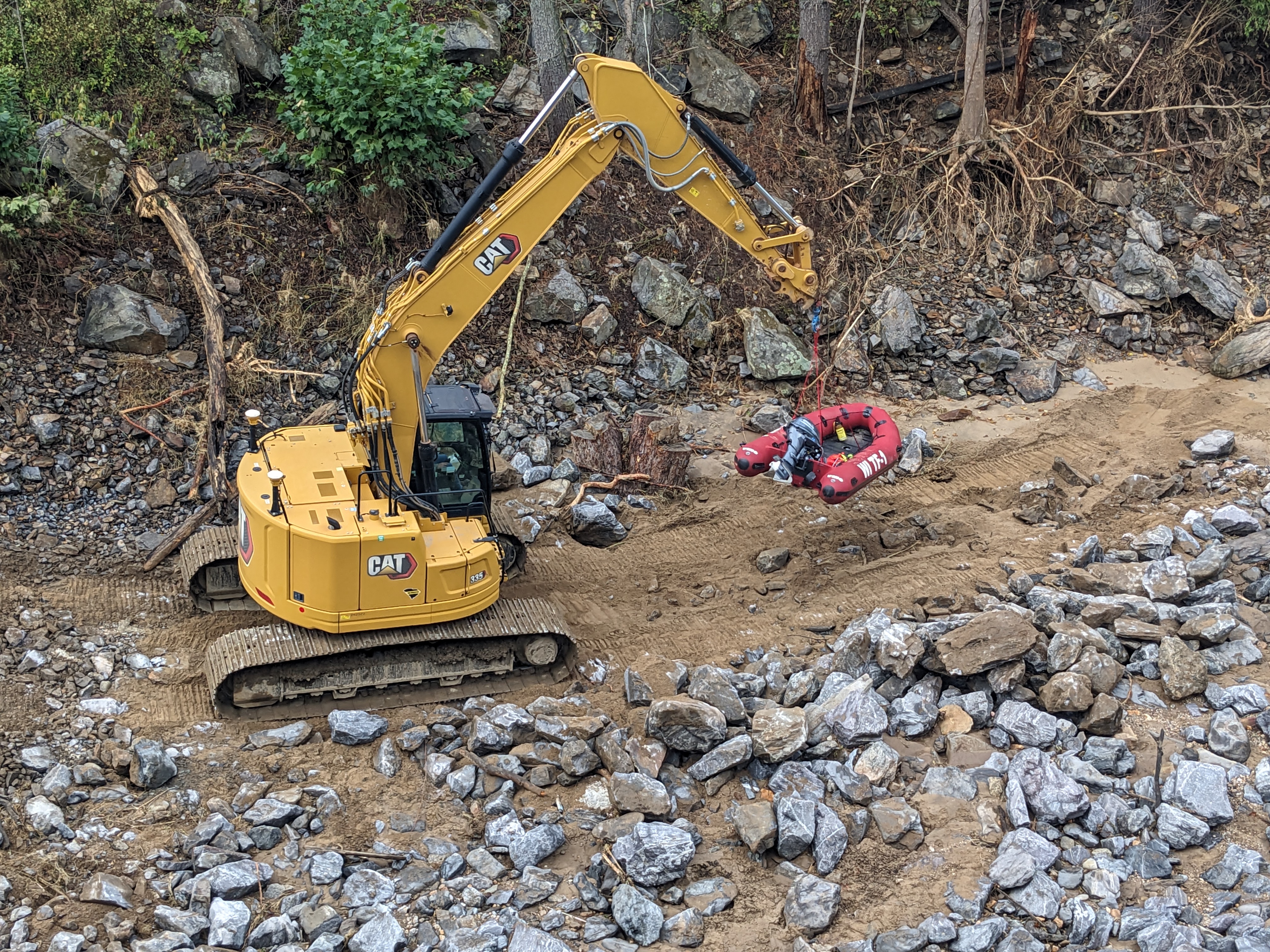
UAS Operations
FAA Part 107 certified reconnaissance, and site documentation. Embedded support with USAR teams and ground operations.
Dashboard & Reporting: Real-time data visualization for command staff and executive reporting for county leadership. Information presented how you need it, when you need it.
Self-Sufficient Infrastructure
You don’t need to provide anything. I arrive with:
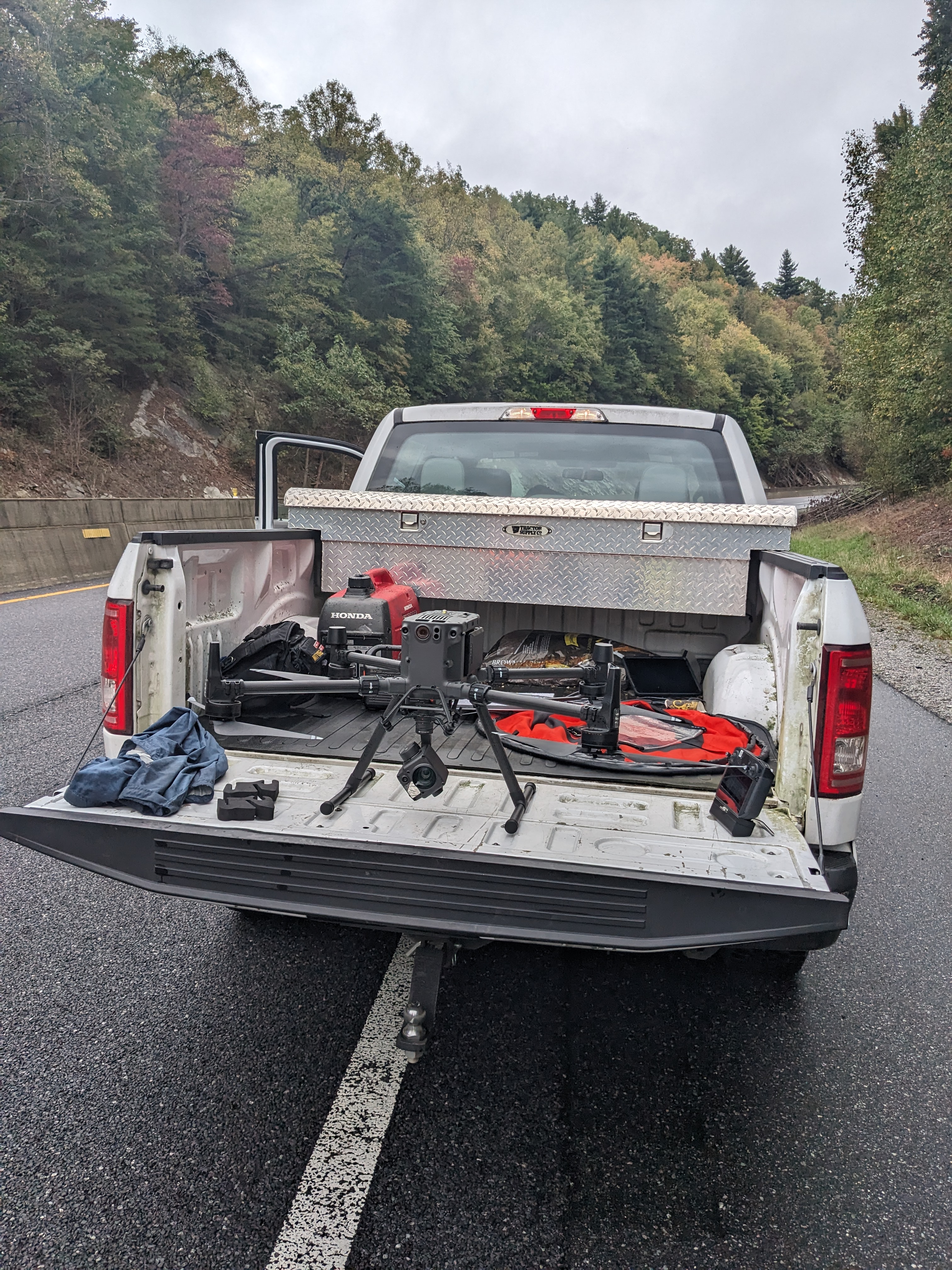
Independent Power
Generator and battery systems for sustained operations without external power
Satellite Connectivity
Starlink functional in infrastructure-degraded environments
Mobile GIS Workstation
Full ArcGIS Pro, ArcGIS Online, and QGIS capability
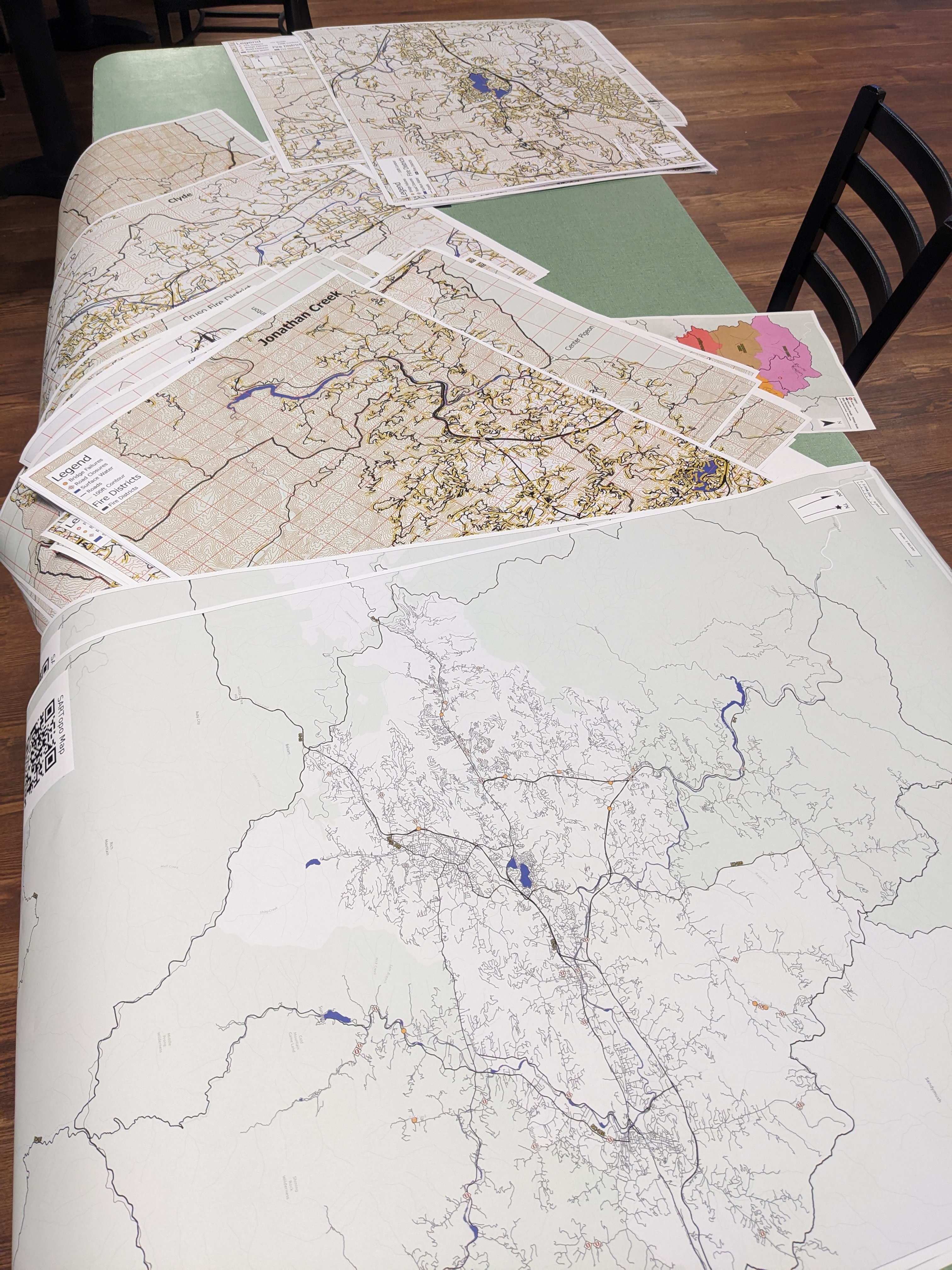
Large-Format Printing
Mobile plotter for on-demand map generation
UAS Platforms
DJI Enterprise drones for aerial mapping and reconnaissance
Deployment Experience
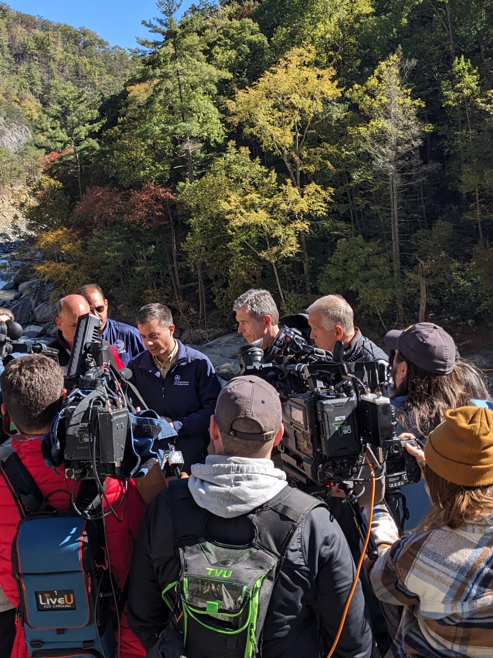
Hurricane Helene (2024)
Haywood County IMT
Situation Unit Leader → GIS Specialist, Planning Section
- Situational awareness dashboards and damage assessment tools for command staff
- Supported a county-wide Post-Emergency Canvassing Operation: 10,000+ residence needs assessment
- Lead UAS Pilot embedded with FEMA/USAR teams
- Pre/post-disaster mapping along Pigeon River
Winter Storm Fern (2026)
Haywood County IMT
GIS Specialist, Planning Section
- Fire district map updates for emergency response coordination
- Situational awareness dashboard enhancement
- Weather intelligence and forecast tracking for county leadership

Deployment Details
Coverage
United States
Home Region
Based in Western NC, deepest experience across the Southeast US
Engagement
Scoped and coordinated in advance; the earlier the conversation starts, the more options exist
What Agencies Ask
“How do you integrate with our existing ICS structure?”
I slot into Planning Section as a GIS Specialist supporting the Situation Unit. I’m trained through O-305 (Type 3 All Hazard IMT) and understand ICS protocols, reporting relationships, and operational tempo.
“What if we already have some GIS capability?”
Great. I augment what you have. If you have staff who can run basic queries, I can focus on complex analysis, dashboard development, or UAS operations. If you have nothing, I can stand up full GIS capability from scratch.
“What does this cost?”
Daily rate based on deployment scope. A 15-minute call will give you a clear picture for your situation.
“How should we time a request?”
As early as possible. Engagements are coordinated in advance, so for anticipated events like hurricane landfall, reach out as soon as your planning starts. Early coordination is what makes support ready when the event arrives.
Start the Conversation
For counties and Incident Management Teams interested in GIS and UAS support for emergency operations. Engagements are scoped and coordinated in advance.
Response within one business day
